The LST: A Survey of a Wreck
The LST: A Survey of a Wreck
Pictures and composition credits: Claudio Provenzani
Maps with results: Luca Carlino
Project Promoter: diveRevolution
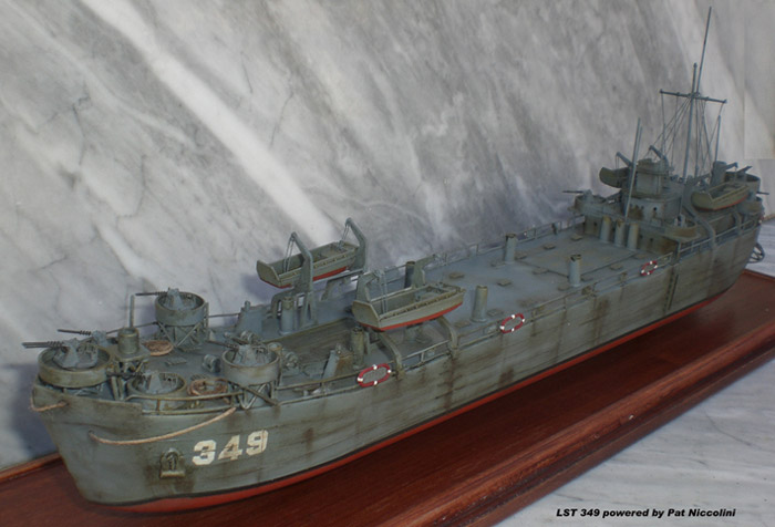
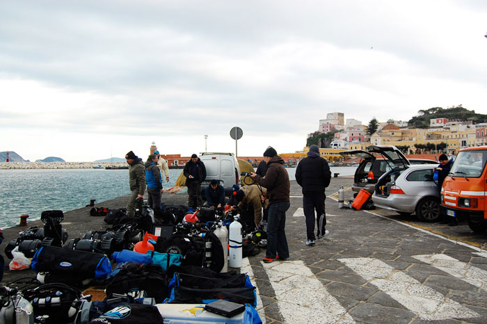
The goal was simple: give GUE Fundamentals divers a chance to practice their newly learned team and management skills while on a real dive with experienced divers. To this end, the team chose to survey a wreck located at a comfortable site in clear, warm, shallow water: the LST 349. A Landing Ship Tank, it sank during the Anzio beachhead conflict in WWII and now rests in two separate stumps on the Cala dell’Acqua sea bottom near Ponza Island (central Tyrrhenian Sea, Italy). The Gravitazero team joined us, invaluable for their experience in the area and their cooperation with the Museo dello Sbarco di Anzio. The main goals of the project were:
- To pinpoint the position of the two wreck stumps using SMBs and a GPS system
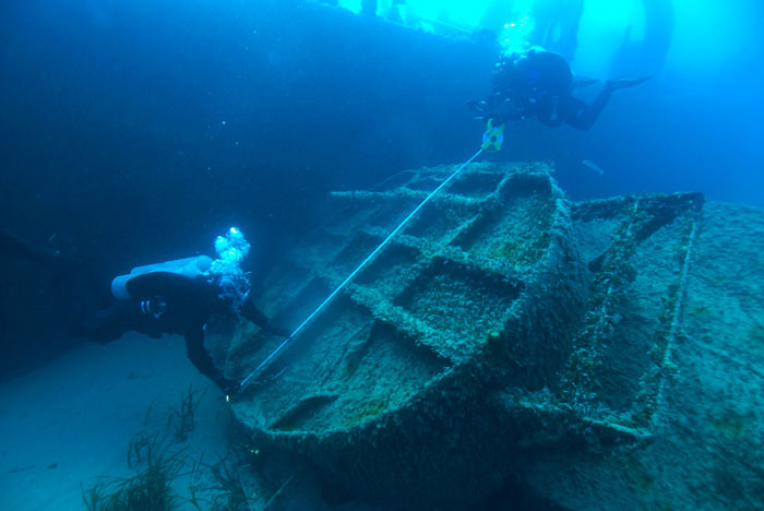
- To take a detailed survey of the wreck and its remains
- To create a 3D reconstruction of the vessel using historical pictures and survey results
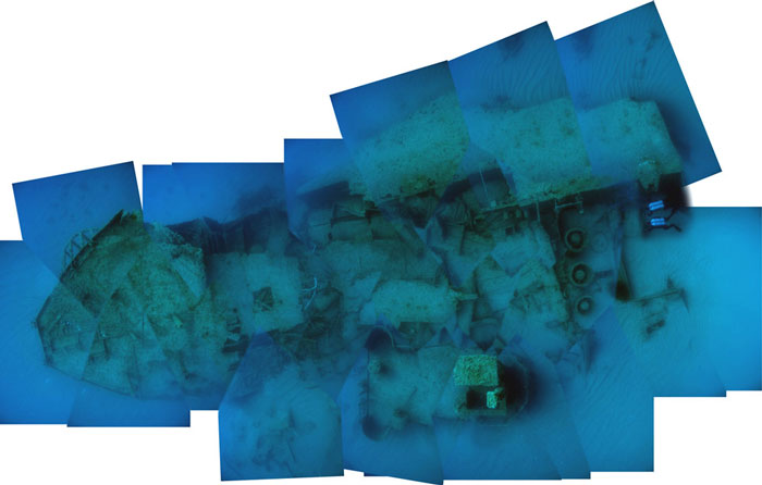
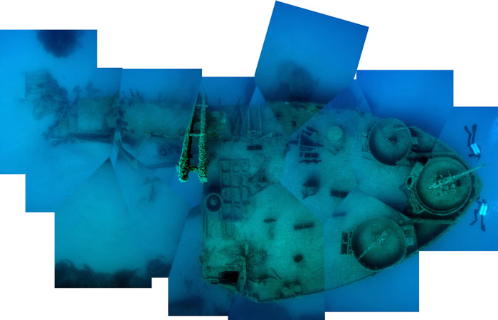
- To acquire a wide shot of the wreck using the same criteria used by archeological surveys
- To take a sedimentological and biological survey to evaluate its potential impact on the marine environment; and
- To publish the results in specialized magazines (Quest, Sub, etc.).
- Video team: two divers would use scooters to film the wreck and divers during the survey
- Photo team: three divers, with one diver to write on the wet notes the position of the objectives in the shots
- Survey team: three divers (one diver to write measures on the wet notes)
- Biological team: three divers (two divers to put a frame on the wreck and the third to take pictures)
- Census team: two divers would use scooter to identify the rests of ship spread around the wreck; and
- Filling gas and elaboration data team, according specific abilities
 The surveys and data elaboration evidenced the correct position of two stumps of the wreck (the bow and stern) as well as the real remains of the ship and its position on the sea bottom. The biological study evidenced a low impact on the marine environment, probably due to the long time it was there. The wide shot proved to be a useful tool for a panoramic view of the wreck and its position in relation to the sea bottom. The most important result, however, was the ability showed by GUE Fundamental divers in this technical and detailed work and how GUE training is very useful for scientific project.
 The GUE divers: Alberto Baldazzi, Alessio Bandinelli, Riccardo Bellelli, Luca Carlino, Marco Cottafava, Davide De Benedictis, Andrea Farnesi, Davide Felicetti, Letizia Gabrielli, Alessandro Gallo, Roberto Giuliani, Paolo Grazzini, Gianfranco Lupidi, Fabio Masiello, Giusy Mauro, Rosella Melia, Massimo Migner, Patrizio Niccolini, Daniele Rosati, Stefano Pasquini, Dino Patrizio, Claudio Provenzani, Elena Romano, Vincenzo Tulone, and Luisella Zocca.
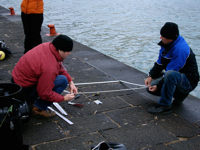
For additional information please visit: www.diverevolution.it and www.gravitazero.org
Privacy Policy © 1998-2023 Global Underwater Explorers
