Cave
Charting Sardinia’s Grotta del Fico
Swiss u/w photographer and tech instructor Gatien Cosendey takes us for a dive into PHREATIC’s recent “Map the Gulf” citizen science project. Their goal? Produce a digital map of Grotta del Fico, one of the major springs located along Sardinia’s Gulf of Orosei, using MNemo devices and Ariane’s Line software. For the citizen scientist in you!
By Gatien Cosendey. Images courtesy of G. Cosendey unless noted.
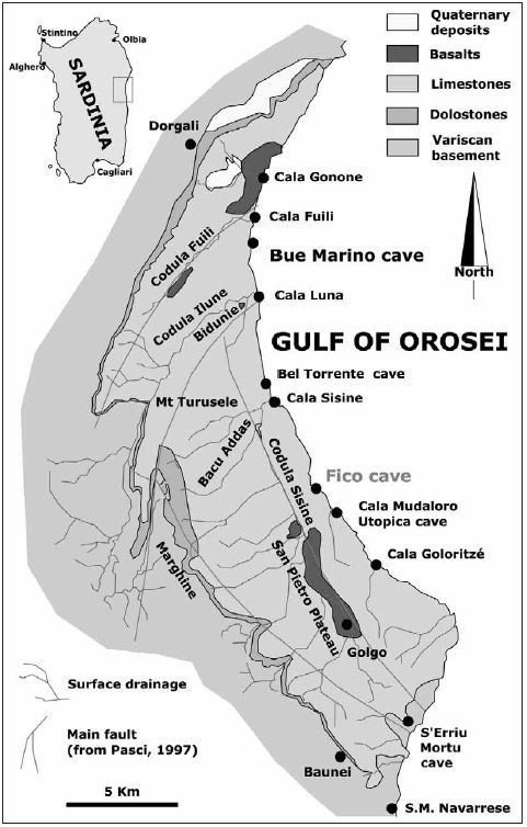
Central-eastern Sardinia’s Supramonte mountain range is one of the biggest karst areas of the island, covering a surface of about 170 km2. It is made of nearly a kilometer-thick layer of limestones and dolostones that covers a granite and schist basement and comprises more than 400 known caves, out of which only two percent contain important groundwater bodies (Cabras et al. 2008). This karst aquifer extends eastward up to the Tyrrhenian Sea and encompasses the Gulf of Orosei, whose 37 km/23 miles long shoreline makes up a succession of vertical carbonate rock cliffs reaching a height of 700 m/2,297 ft (Sanna and De Waele 2010). The main cave diving springs along the Gulf of Orosei are; Grotta del Bue Marino, Bel Torrente, Risorgenza di Cala Luna, Utopia, Euforia, Grotta del Fico and Macedonia.
Based in Cala Gonone, Phreatic is a nonprofit organization founded in 2014 by a group of explorers, researchers, and scientists who are mainly active in the Supramonte plateau and Gulf of Orosei areas. Their stated mission is to advance knowledge about groundwater resources and marine caves, and to insure their protection and conservation, with projects covering a broad spectrum of topics including environmental processes, geology, speleology, marine biology and conservation.
We believe it’s important to raise public awareness of not only how important these fragile karst geo-ecosystems are, but also about the hazards related to these environments, such as sinkholes and flash floods. “Map the Gulf” is one of the ongoing projects from Phreatic, and it relies on citizen science to gather data and survey flooded caves of the Gulf of Orosei with the goal of making all the resulting data available to the public.
Indeed, the available data on these cave systems is scarce outside of the dry passageways, and detailed and complete maps are missing. The latest Map the Gulf campaign started in March 2022 and focuses on Grotta del Fico. Operations are run from Base1 Sardinia, a dive center located in Cala Gonone delivering logistics for cave and wreck diving in the Gulf of Orosei (See PHREATIC).
Phreatic Exploration
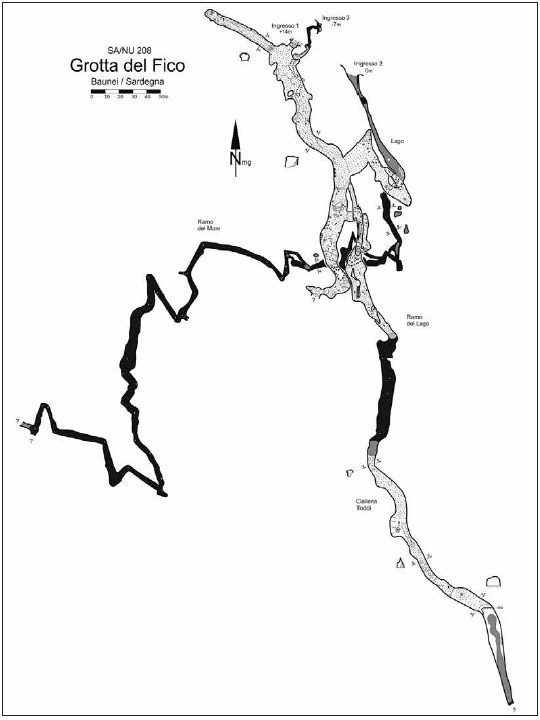
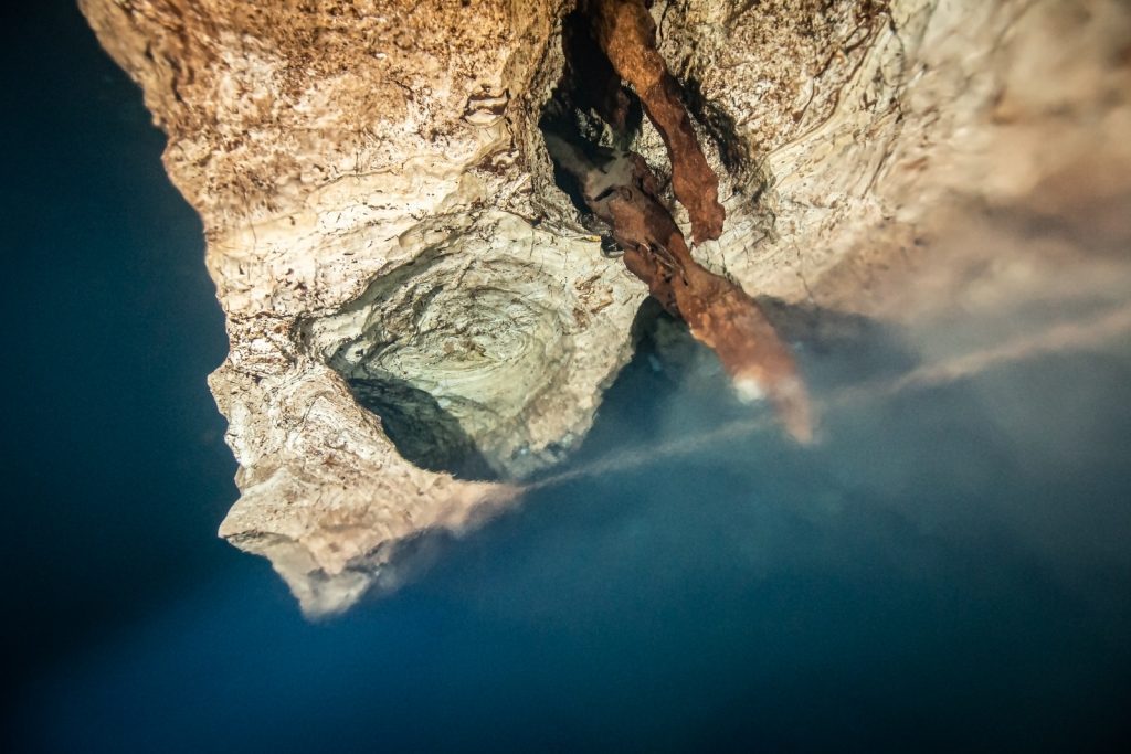
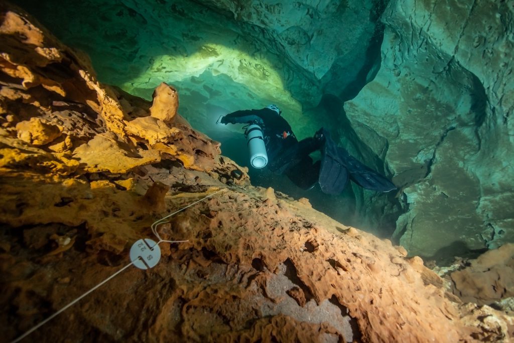
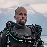
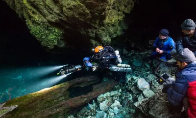
Grotta del Fico, together with Bue Marino, are the two cave systems of the Gulf, which have dry passageways open to tourists in addition to underwater conduits for cave divers. Each summer more than 15,000 visitors come and admire the beauty of the speleothem formations within Grotta del Fico, accessing the cave through the main entrance located 10 m above sea level on a steep cliff. Two other entrances open underwater, one of them being used by cave divers.
Cave exploration of Grotta del Fico started in the 1960s, and recent exploration revealed a total development of cave conduits to more than 2.5 km/8203 ft. These conduits are characterized by a main air-filled passage parallel to the coastline and a smaller mostly submerged branch running perpendicular to the coast (Sanna and De Waele 2010, D’Angeli et al. 2013).
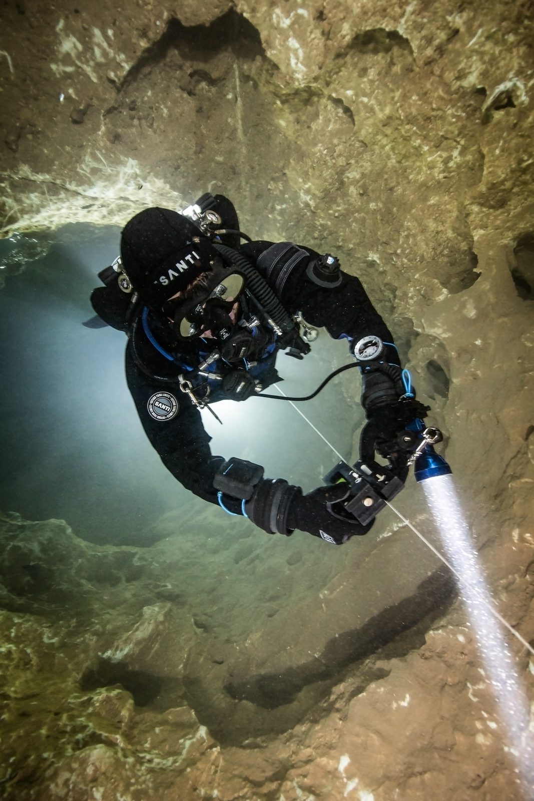
I joined the second project session, which took place from June 19-24, 2022. I arrived one day early and teamed up with two fellow project attendees for a warm up dive in Grotta del Blue Marino It is worth explaining the logistics required to dive caves in the Gulf of Orosei—the aforementioned caves are underground rivers that spring directly into the sea, which means that the natural access to dive these caves is from the ocean.
As mentioned, the shoreline is mainly made of high cliffs; therefore, the Gulf of Orosei is only one of few locations worldwide where a rigid-hulled inflatable boat (RHIB) ride is the normal way to go cave diving. For the same reason, cave divers will experience both a halocline and a thermocline while transitioning from the warm seawater to the cool freshwater of the caves.
The project week started with a full classroom day led by project leader, Base1 co-founder, and Global Underwater Explorers (GUE) cave Instructor Examiner, Andrea Marassich. The session included a general orientation about local geography and geology, an overview of the project, a statement of objectives, and detailed explanation of methods and procedures. As mentioned, this year’s Map The Gulf campaign is focused on surveying Grotta del Fico’s main flooded passageways.
The Digital Surveying Process
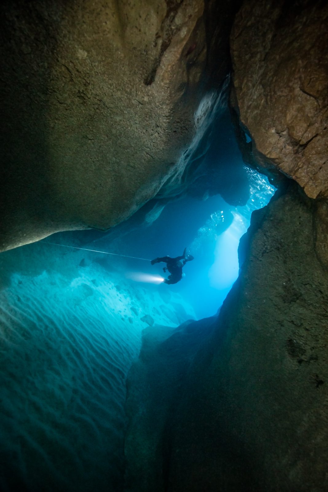
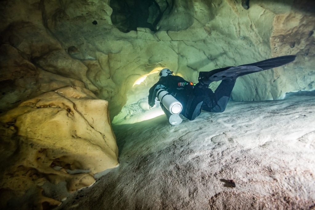
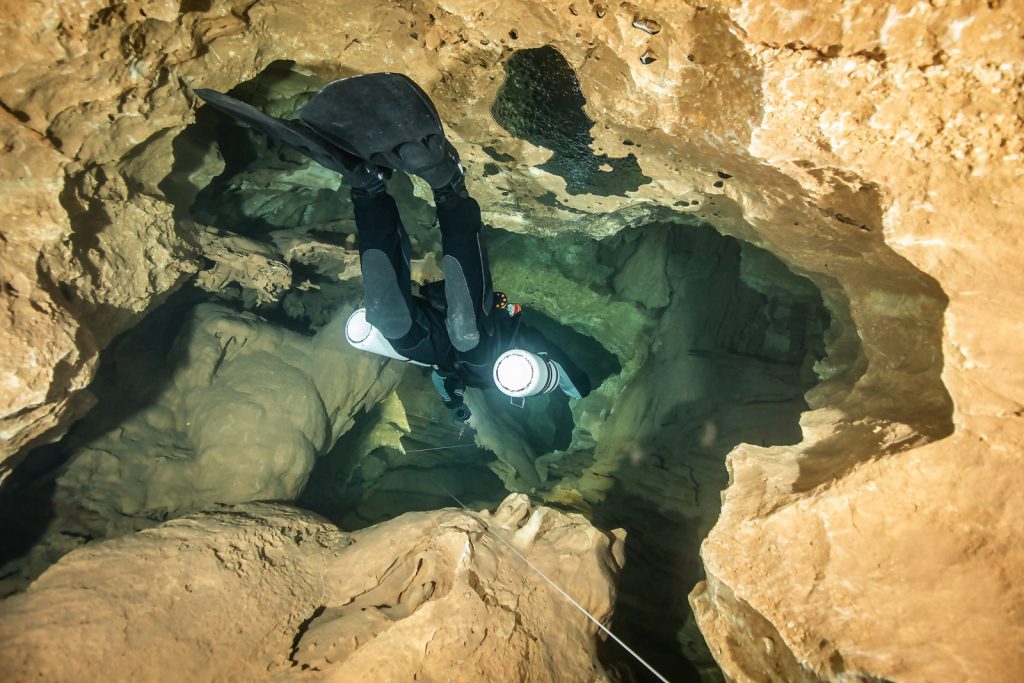
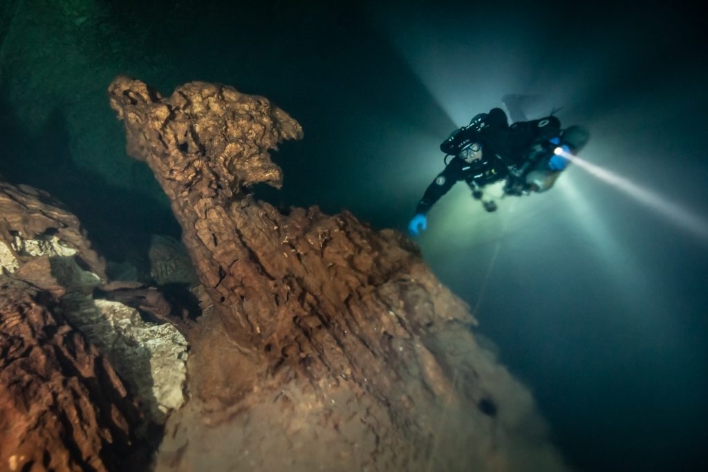
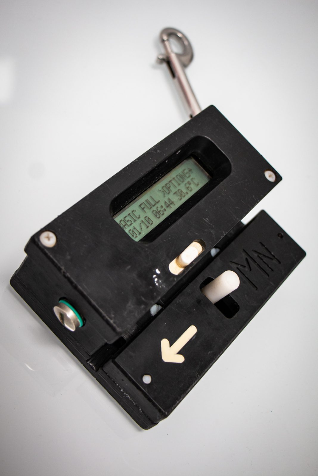
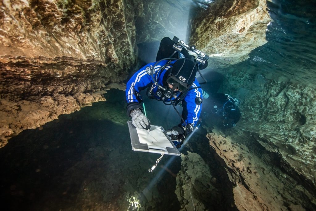
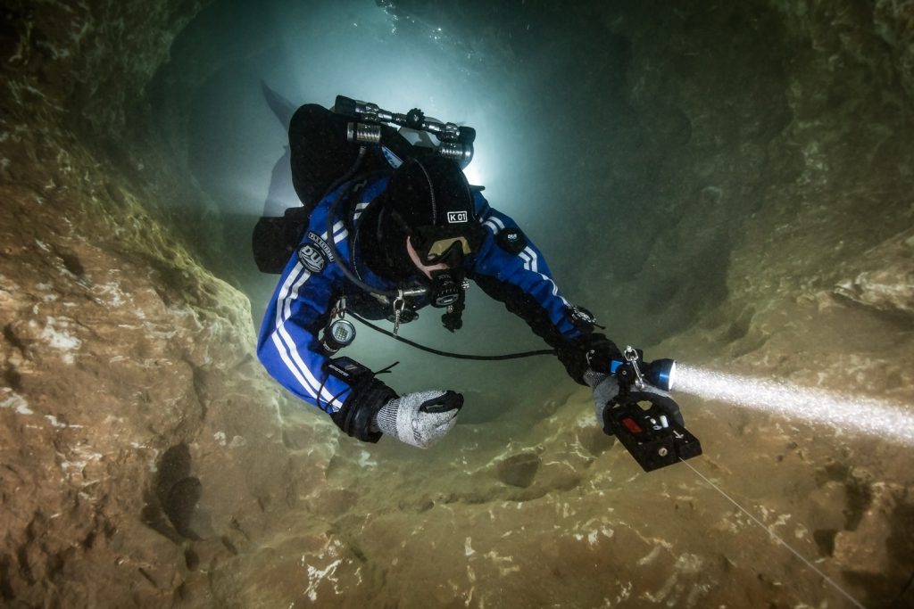
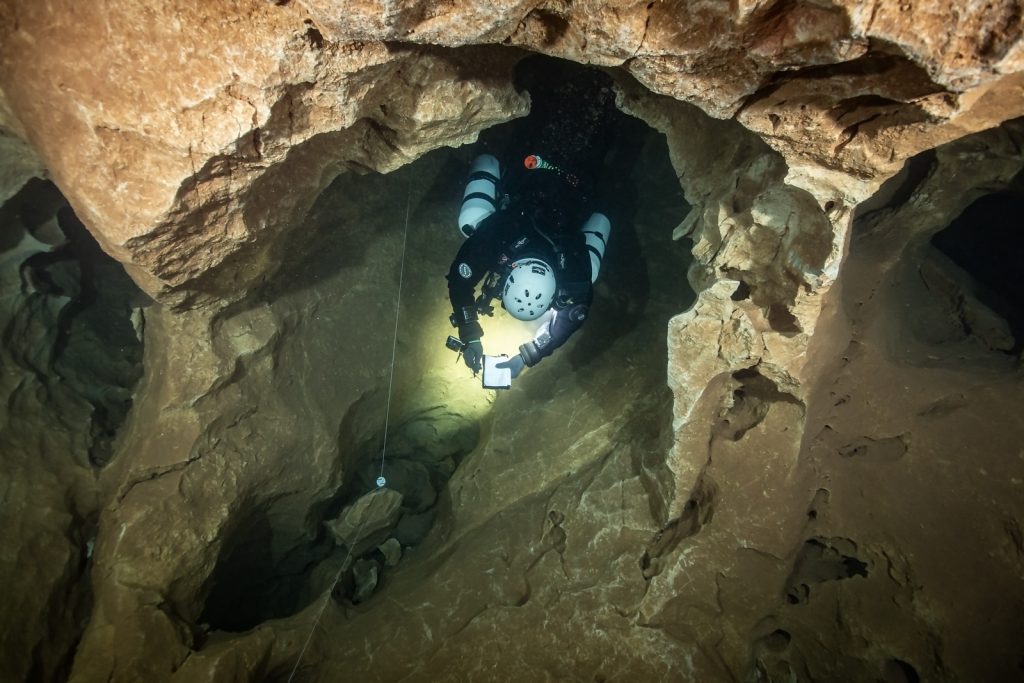
The survey process can be broken down into the following steps; First, stations are defined using numbered cookies, a.k.a. survey cookies, which are placed at each tie-off, tee, and jump arrow of the cave main line. These stations help to spatially reference the different types of data that will be subsequently acquired. The next step makes use of a MNemo device from Ariane’s line to acquire stick map data: the MNemo is clipped onto the main line, measures distances using an optical sensor while running along the line and acquires depth and azimuth angle at both the beginning and end of segments between stations. Afterwards, left-right-up-down (LRUD) distance estimates are collected at each station and written down in wetnotes and correspond to the available space for a diver to swim through the given cave section.
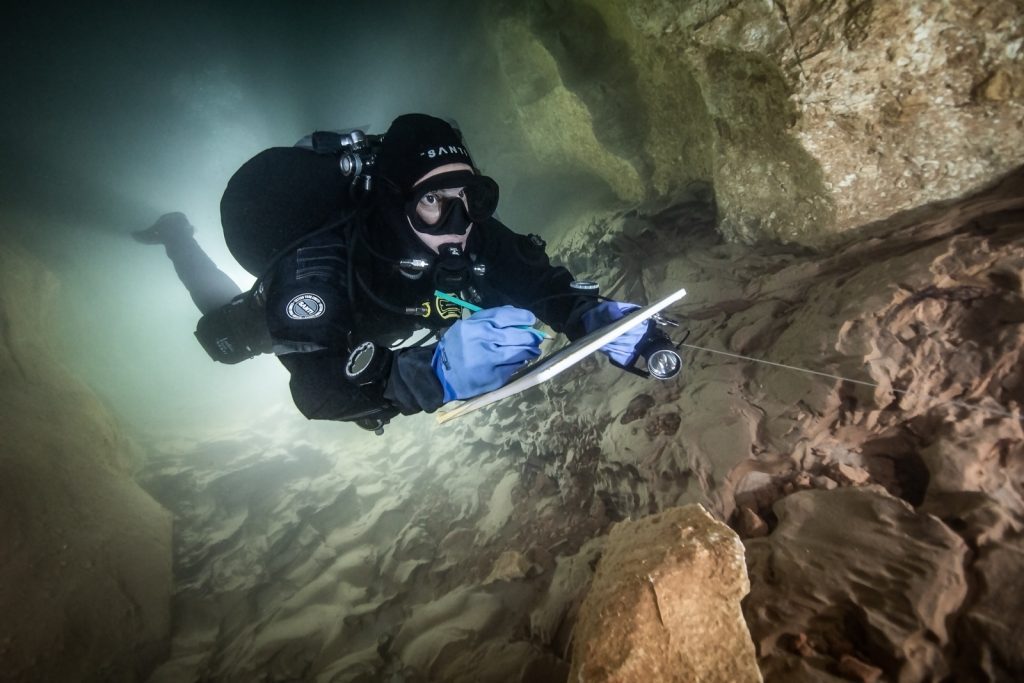
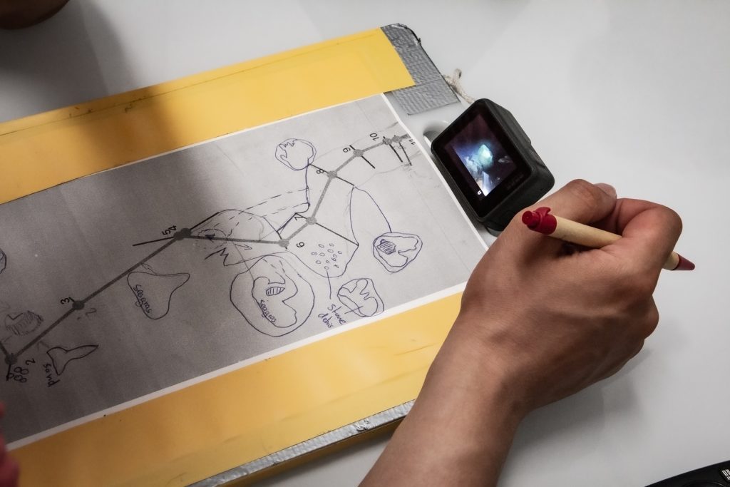
Both MNemo and LRUD data can be collected simultaneously by a buddy pair and will at the end of the day be loaded into Ariane’s Line software (or equivalent) in order to produce the cave stick map with polyhedral volume estimates. The resulting stick map and LRUD distances are then printed on water friendly paper, taped onto chopping boards and taken with a pencil into the cave. While one diver sketches details of the cave walls and features, his buddy records videos of the corresponding passage for further reference. This enables the divers to complete or correct the drawing outside of the cave while watching the videos with survey cookies referencing the video sequences with respect to the sketched map.
The afternoon was about a MNemo dry run with everyone practicing correct use of the device and subsequent data loading into the dedicated software. The day ended up with some of us going for a test dive from shore, the others enjoying the beach. Note that this first day was the only one to be light enough for us to have a bit of chilling time.
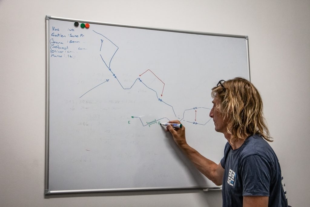
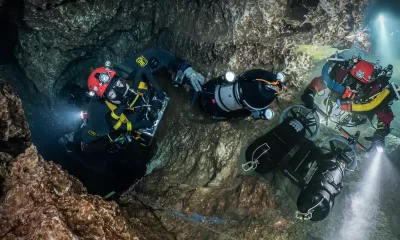
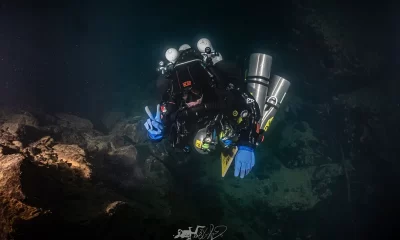
Teams were formed on the first day: a GUE Cave 2 (C2) team, a GUE Cave 1 (C1) team, and finally my team, the TDI “freak” team. Indeed, my buddy was diving sidemount and I was flying the Divesoft Liberty CCR, both of us being full cave divers. Previous teams had obtained MNemo stick map and LRUD data of a first segment of the cave of about 175 m during the first 2022 project week and started sketching it. Therefore, the one team would primarily focus on sketching and shooting referencing videos of this first segment, while the other teams would venture further into the cave and start surveying the next segment.
The C1 team’s plans for the week were quite straightforward. Diving on thirds of 2/3 of their total gas, their limited reach would not allow them to penetrate far into the cave. However, their skills would be precious to make use of the previously acquired stick map and LRUD data and sketch the first segment of the cave.
Recalculating their gas after exiting the cave, they were able to perform two dives per twinset, bringing their total dive count per day to four as they were taking a second twinset on the boat. As the first segment of the cave is below 10 m/30 ft, they had plenty of time to carefully draw details of the cave map plan and profile views as well as the main cave features. Using videos shot during their dives, they were able to further refine their sketches during the data processing time at the end of each dive day.
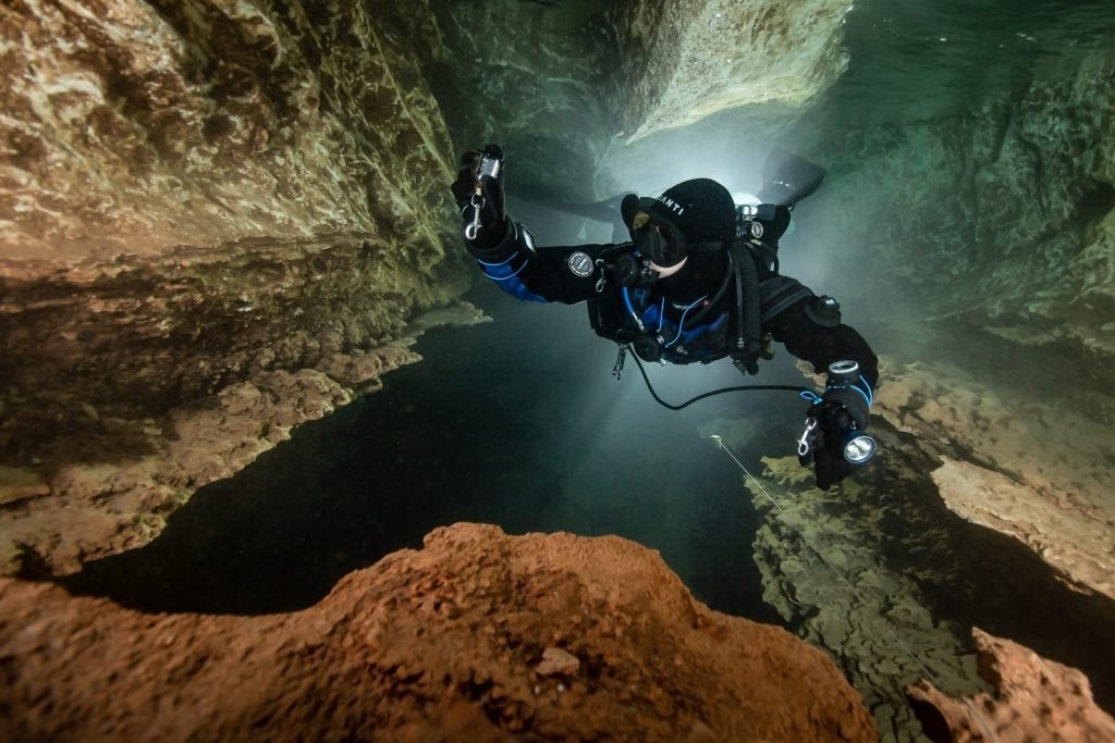
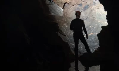
The other two teams took one, sometimes two, stages performing one long dive and extending the survey past the first segment. The tasks performed were, in order: drop survey cookies at all stations, data acquisition for the stick map with the MNemo, LRUD data collection, and finally sketch of cave walls and features. The mixed team also surveyed two bypasses within the first segment while the C2 team laid some new line in the far end of the first sump. In addition to the survey tasks, I also took my camera on four out of the five dives that we performed, sometimes juggling between the camera and the MNemo to fulfill all objectives. Well, to be honest, I screwed up my first MNemo measurement, which explained why I had to deal with both the MNemo and the camera on the next dive.
I would like to thank my buddy Vas for taking care of the navigation and most of the data collection, allowing me to play with my camera. We also took the time to stage a few shots on the last dive, which was pure bliss given the discipline and skill level of all my teammates. We spent a total of more than 13 hours underwater over the five project dives.
Bringing Home the Data
Back from the dive, we met at the dive center and processed the newly acquired data. This was a decisive moment, where we would know whether the data collection was properly done, or not. We also planned for the next day’s dives. Setting up the gear in the morning, loading everything in the dive center van, transferring the gear into the RHIB, the half hour boat trip to the cave, and everything in reverse on the way back, plus rinsing the gear, taking care of the rebreather and the camera, charging all video lights and strobes, sorting and processing the daily pictures—the week was gone before I noticed.
During this week, our common efforts bring the stick map length and the sketched plan and profile views to a total distance of 410 m/1345 ft. We replaced 590 m/1936 ft of the old line and took many cool pictures. Most importantly, we all learned a lot and came back with new friendships and awesome memories! There is still a lot of work to be done, and the project will continue with additional survey sessions.
I would like to thank my teammates Joana, Sebastian, Oliver, Marco, and Vas for this great session!
Videos of each day of the June project can be found here:
This month we’re launching a survey panel on dive computing. Please help us by sharing your thoughts & practice at: Dive Computers-Exploratory Survey.
References
Cabras S, De Waele J, Sanna L. 2008. Caves and Karst Aquifer Drainage of Supramonte (Sardinia, Italy): A Review. Acta Carsologica / Karsoslovni Zbornik. 37. 227-240. 10.3986/ac.v37i2.148.
D’Angeli IM, De Waele J, Ruggieri R, Sanna L. 2013. Pleistocene sea level changes as revealed by flank margin caves in telogenetic limestones in Sicily and Sardinia (Italy). Proceedings of the 16th International Congress of Speleology, Brno 19-27 July 2013. 3.
Sanna L, De Waele J. 2010. Karst landscape and caves in the Gulf of Orosei (Central-East Sardinia): a scientific and cultural resource. 10.13140/2.1.2783.0728.
Dive Deeper
Website: Phreatic: Citizen Science and groundwater research.
Website: Ariane’s Line
InDEPTH: EXPLORING AND DOCUMENTING SA CONCA ‘E LOCOLI CAVE by Andrea Marassich.
InDEPTH: Data for Divers: Mexican Explorers Go Digital to Chart Riviera Maya by Michael Menduno
Gatien Cosendey is a Swiss underwater photographer and technical/CCR instructor. When not traveling across Europe to enjoy caves, mines, and wrecks, he mainly dives the cold and dark Swiss lakes around his hometown. He loves shooting photos in all sorts of environments, ranging from deep caves to frozen mountain lakes. Besides diving, Gatien holds a PhD in Photonics and works as an optical engineer in the field of augmented and mixed reality.


Dial In Your DCS Risk with the Thalmann Algorithm

Deep Tunnel Workers Go Trimix

La Grande Dérive

California Dreamin’

British Invasion—Thailand Karst Edition 2024

Harnessing the Power of ‘Educated’ AI to Improve Diving Safety